
Sustain Bloomington Farm Informational Map
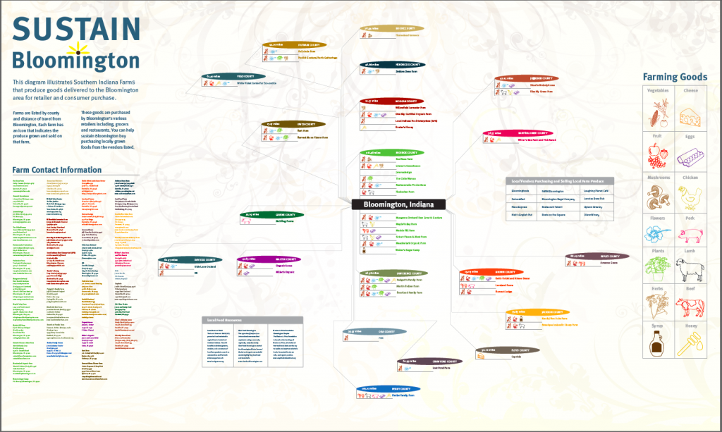
This mapping system is used for an exhibit piece for informational purposes. The size is 6ft x 10ft and acknowledges all the farms in Southern Indiana, what they produce on their farm and how far (in miles) they are from Bloomington, IN. All these farms grow food and sell to vendors in Bloomington, IN. This map shows not only what they grow but how far they need to travel to make a delivery in Bloomington, IN. This way one can access gas usage. Also, by acknowledging the farms that provide to the Bloomington,IN area publicly; consumers can learn to support these farms/farmers and make locally grown purchases. These are my original illustrations.
Mobile App and Web Referral